|
GR181 Gavdos and Gavdopoula islands
 |
 |
Criteria: B1i, B2, C2
Coordinates:
34o 51' N
24o 5' E
()
|
Altitude: 0-386 m
Area: 3600 ha
|
|
 |
 |
Images
Site Description
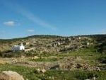
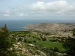
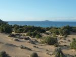
Two islands south of Crete. Gavdos is covered with maquis, phrygana, and Pinus and Juniperus forest. Gavdopoula is covered with phrygana.
 |
 |
Habitats: Artificial landscapes (10%, Perennial crops, orchards and groves), Coastline/rocky areas (10%, Sea cliffs and rocky shores), Forest (30%, Native coniferous woodland), Sea/marine area (10%, Open Sea), Shrubland (50%, Sclerophyllous scrub, garrigue and maquis)
Land use: agriculture (10%), fisheries/aquaculture (10%), not utilised, tourism/recreation (10%)
|
 |
 |
Protection status
National None International None
1564 ha of the IBA are covered by Special Protection Area (SPA) NOTIODYTIKI GAVDOS KAI GAVDOPOULA(GR4340023).
Birds
This is an important area for passage migrants.
| Species | Season | Year | Min | Max | Acc | Criteria |
|---|
| Otus scops Common Scops-owl | breeding | 1996 | Abundant | unknown | B2
|
| Phalacrocorax aristotelis European Shag | resident | 1996 | 150 | - | average | B1i, C2
|
|
Conservation issues
The main threats include uncontrolled tourism development and plans to construct an industrial unit on Gavdopoula islet. The area is a candidate SAC.
 |
 |
Threats:
abandonment/reduction of land management (high), afforestation (medium), burning of vegetation (medium), industrialization/urbanization (high), infrastructure (high), unsustainable exploitation (unknown)
|
 |
 |
Source:
Copyright © Hellenic Ornithological Society
|
|

Do you know the area?
Send us your comments at iba@ornithologiki.gr
If you have noticed serious damage to the area and you want to report it please click here
 
|


